On Ilkley Moor without a hat

Sunday May 11, A walk on The Moor
There’s a popular song about the region (Ilkley Moor) that we see every morning from “our” apartment in England – rain and mist permitting! It may be amusing (or indecipherable) to some but is presented here as an introduction to a beautiful walk that I took on that moor today. The sun shone, the rain came in torrents, clouds predominated – but, within a mile of the apartment, I saw some of the most rugged and beautiful terrain that is Ilkla Mooar.  I hope that the pictures below allow you to enjoy the walk with me.
Wheear ‘ast tha bin sin’ ah saw thee, ah saw thee?**

On Ilkla Mooar baht ‘at
Wheear ‘ast tha bin sin’ ah saw thee, ah saw thee?
Wheear ‘ast tha bin sin’ ah saw thee?

On Ilkla Mooar baht ‘at
Tha’s been a cooartin’ Mary Jane
                          Choruse!
Tha’s bahn’ to catch thy deeath o’ cowd
                          Chorus
Then us’ll ha’ to bury thee
                          Chorus
Then t’worms’ll come an’ eyt thee up
                           Chorus
Then t’ducks’ll come an’ eyt up t’worms
                           Chorus
Then us’ll go an’ eyt up t’ducks
                           Chorus
Then us’ll all ha’ etten thee
                            Chorus
That’s wheear we get us ooan back
                            Chorus
 

** For those who want to sing along, the tune is “Cranbrook”, found in the Methodist Hymn Book and still used in the US for the hymn

” Grace! ‘Tis a Charming Sound”

DSC01168

The Cow and Calf Rocks

DSC01165

My path through the Bluebell Woods

DSC01154

A somewhat more rugged path

DSC01156

Ilkley Moor

DSC01152

Beautiful waterfalls abound

DSC01166

Bluebell Woods

Permanent link to this article: http://tykesabroad.com/on-ilkley-moor-without-a-hat/

Ilkley Carnival, May 5 2014

We are now in England, staying in our nephew’s flat in the small Yorkshire town of Ilkley.

Ilkley is a spa town and civil parish in West Yorkshire, in Northern England. Approximately 12 miles north of Bradford, the town lies mainly on the south bank of the River Wharfe in Wharfedale, one of the Yorkshire Dales. The parish has a population of around 16,000.

Ilkley’s spa town heritage and surrounding countryside make tourism an important local industry.

The town center is characterized by Victorian architecture, wide streets and floral displays. Ilkley Moor, to the south of the town, is the subject of a folk song, often described as the unofficial anthem of Yorkshire, “On Ilkla Moor Baht ‘at“. The song’s words are written in Yorkshire dialect, its title translated as “On Ilkley Moor without a hat.”

Yesterday (May 5) was a “Bank Holiday” (similar to the US Federal Holidays) and it was also Ilkley Carnival Day. The carnival itself (fair, rides, games, soccer tournament, noisy rock bands) was centered on the rugby grounds close to the river but the highlight for many was the parade through the middle of town. It had a pipe band, a brass band, an Air Force Cadet band, several cyclists (the Tour de France will pass through Ilkley in July) and hundreds of kids in costumes representing local activities and functions. It certainly wasn’t the Rose Parade but, on a beautiful warm and sunny day, it was a very pleasant way to spend an hour – and to raise money for local charities. Last year the Carnival attracted a crowd of 10,000; not bad for a town with less than twice that in total population, and a number that was expected to be exceeded yesterday.

Ilkley residents in their finery

Ilkley residents in their finery

Ilkley is a popular place to visit but it's not usually this crowded!

Ilkley is a popular place to visit but it’s not usually this crowded!

The future Royal Air Force

The future Royal Air Force

Pipe bands are always popular

Pipe bands are always popular

Brass Bands are very common in the North of England

Brass Bands are very common in the North of England

Presumably the Grand Marshall - with local dignitaries atop the bus

Presumably the Grand Marshall – with local dignitaries atop the bus

Permanent link to this article: http://tykesabroad.com/ilkley-carnival-may-5-2014/

Israel, Days 8 and 9: Galilee

On Wednesday we drove in a north-easterly direction which climbed east of the Carmel range and across the Armageddon Plain. Armageddon is mentioned in the Book of Revelation and has an apocalyptic connotation but the Hebrew words mean simply Strong Mountain. Being at a strategic point on many ancient trade routes, this area has seen many battles and a number of cities built and destroyed. We were told that a small hill is actually a site on which several cities had once existed, each built above its predecessor (presumably destroyed or abandoned). Whether or not this spot (mentioned frequently in the Old Testament as Meggido) will be the scene of a literal or symbolic apocalypse, it is today set in a beautiful region of Israel, not unlike northern Italy. On this stretch of road, which changes from mountain pass to deep valley rather frequently, we caught several views of Mount Tabor, a 2000 feet unusually rounded hill believed by many to be the site of the Transfiguration of Jesus.

DSC00904

Mt Tabor – The Mount of the Transfiguration

Our first stop was in the city of Nazareth. The city is built on a steep hillside and houses the Church of the Annunciation and the Church of St Joseph, both built on the presumed sites of Mary’s and Joseph’s homes.

The Church of The Annunciation, Nazareth

The Church of The Annunciation, Nazareth

The Church (Basilica) of the Annunciation is a particularly attractive and tranquil sanctuary, especially compared with the frenetic chaos inside the Bethlehem nativity site. The cave-like home is on the entry level to the church and has a simple altar and a peaceful ambiance. The modern church above is relatively simple but quite beautiful and the walls are adorned with mosaics of the Virgin donated by Churches from around the globe.

DSC00842

Mary’s Home


The Church of St Joseph is more modest but has excavations that reveal a site that could have been either the home or the carpentry – or, since the Crusaders had also built on this site – neither. Once again we were conscious of the fact that two thousand years have elapsed and that it was perhaps four hundred years before anyone tried to identify specific sites in the first centuries of Christianity. It is not surprising, therefore, that there could be confusion as to the exact locations of any Biblical site. We were nevertheless in Nazareth and the fact that we may or may not have seen the exact place of Joseph’s shop (or indeed of Mary’s birth) was of little consequence. This was not the interpretation of many of our fellow visitors who chose to accept these small caves or ancient stones as a truly Holy site and acted with due reverence. It must also be said that there was the other extreme in tourists who seemed more intent on being photographed (sometimes in glamor magazine fashion) in front of these sites than on any religious, historical or cultural experience.

DSC00892

Joseph’s Home


From Nazareth we descended to catch our first glimpse of the Sea of Galilee and passed through the village of Cana, where water was turned into wine to prolong the festivities at the Wedding Feast. We also saw the city of Tiberias which had been built by one of the two sons of Herod the Great in honor of the Roman Emperor. Our guide suggested that it was probably not visited by Jesus, perhaps due to its Rome connections but more likely as it was a town of Judea where the new teachings would not have been well-received. It should be noted, however, that the Sea of Galilee is often referred to as the sea of Tiberias so there is room for further confusion and doubt.

We were now at the Sea of Galilee, which is 600 feet below sea level, below that of Death Valley in the USA but significantly higher than the Dead Sea to the south. Our first stop on the side of the lake (it is only 64 square miles) was at the Church of the Multiplication of Fish and Loaves where Five Thousand were fed. The church here is also very peaceful and simple and the only feature relating it to the event is a rock marking the site of the miracle, covered by a simple altar.

DSC00935

The Rock under the altar marks the presumed site of The Multiplication


Not far from this Miracle Site is the Town of Capernaum, commonly referred to as the Town of Jesus. It was actually the home of St Peter but where Jesus spent much of his time. A church has been built here over the site of the home and in this case it has been done without destroying the archeological site below by simply placing the church on legs that straddle the old buildings. Very close by is a synagogue (actually two – one built directly on the foundations of the earlier one) where Jesus might have taught.

DSC00948

The Synagogue where Jesus might have taught


DSC00952

The Church of St Peter, Caperneum 


A beautiful statue of St Peter sits in a pleasant courtyard overlooking the Sea of Galilee and – in the absence of tourists wishing to be seated at its base for the inevitable photograph – provides a very attractive scene. With the odd fishing boat out on the Lake, one could easily imagine it as a scene that Jesus Himself would have recognized as much of his ministry was centered in this area.


DSC00978

St Peter with the Sea of Galilee in the background


We then drove around the eastern shore of the Sea of Galilee, having crossed the Jordan River at its point of entry to the lake. We were then at the base of the Golan Heights, an area that has seen much conflict and one which was taken by Israel from Syria in the 1967 Six Day War. This, a large section of Jordan west of the Jordan River (The West Bank) and the Gaza Strip were each brought into the State of Israel as a result of that short but one-sided war against Syria, Jordan and Egypt. The drive along the eastern shore, in this annexed region of the Golan Heights, was very attractive and the hills to the east and north were again very reminiscent of northern Italy. At first glance it appeared that the hillsides we could see were unoccupied but closer inspection revealed dozens of villages and towns, filled with new Israeli citizens!


At the southern end of the Sea of Galilee we crossed the Jordan River to the west and made our final stop for the day at the Baptism Site. This is a well-organized and commercial site that  may or may not be the place where John  the Baptist baptized Jesus. But it does sit on the western bank of the Jordan River, is close to Jericho and has been designated as such for those who wish to accept. When I mentioned to our guide that we had visited “the Baptism Site” on the other side of the river and further south in Jordan, he simply responded that no-one claimed this as the one true place. The site we had visited several years ago was not actually “in” the river, although not more than a few yards from the slowly flowing water. An early church had been built at that site in Jordan; no such “statement of authenticity” had been made here.

DSC01027

The Baptism Site

However, this site in Israel was actually on the River Jordan and areas had been prepared and surrounded by railings so that those inclined could be baptized in safety and, with the aid of a robe available from the gift shop for $25, in relative modesty. Although there were a number of obvious church groups here and some may well have had ordained ministers to perform the ceremony, it would appear that immersion baptisms here were mostly self-imposed or performed by friends or family. It is not for those like us, who simply chose to watch, to challenge either the authenticity or its impact on those who actually participated.


DSC01037

Final look at the Sea of Galilee

Following this visit it was time to leave the hot valley (high temperature for the day was almost 100F) and take the two hour drive back to Tel Aviv. The climb out of the river valley was steep and had spectacular views of the River Jordan and the Sea of Galilee and much of the rest of the way was through the fertile plains and modest hills of Central Israel. We arrived back at the hotel almost exactly 12 hours after we had left, tired but so pleased that we had taken this tour “In the Footsteps of Jesus”.

This essentially ended our visit to the Holy Land as we used Thursday to simply relax and wind down after a hectic but moving eight days in this wonderful country.  On Friday it was on to more familiar territory in England.


Permanent link to this article: http://tykesabroad.com/israel-days-8-and-9-galilee/

Israel, Days 6 and &7: Tel Aviv and the Coast

On Monday (April 28) we left Jerusalem by taxi and in a little over an hour we were in our hotel on the shore of the Mediterranean Sea in Tel Aviv. We did little more that day than take in our new surroundings which, it soon became obvious, were quite different from those we had left in Jerusalem. Tel Aviv is a much more cosmopolitan city and, although a smaller city than Jerusalem, it has a much bigger metropolitan area and seems much busier. It is the economic, cultural and technology center of the country and in many respects, just like many other cities in the world. It struck us immediately that the obvious ethnicities, clearly identified by dress if nothing else in Jerusalem, were amalgamated here and religious differences were not nearly as clearly delineated. So this city as a destination would not have been a choice we would have made but it does provide a more convenient starting point for several of the historical sites that we wanted to visit over the next couple of days. And a hectic, exciting, educational and moving two days they turned out to be!

Early Tuesday morning we left with the blue Mediterranean on our left side and drove north to our first stop at the ancient city of Caesarea, built by King Herod in honor of Caesar Augustus. It is right on the sea shore and has a good selection of ruins that give an appreciation for its size and amenities. There is a 4000 seat amphitheater, a huge stadium (only recently excavated and with its long terraces of seats intact) and the usual palatial rooms with mosaic floors, etc. There were, however, very few statues as ornamentation, as Jews then (and now) have only geometric shapes to adorn their buildings. Herod was not a Jew by birth (although he did marry a Jewish woman) but he was smart enough to know how to handle not only his Roman leaders but also the people over whom he had virtually supreme power.

The vast Caesarea site with the stadium seating

The vast Caesarea site with the stadium seating

Caesarea Roman City

Caesarea Roman City

From Caesarea we drove to Haifa, the third largest city in Israel and its major port. Here we climbed Mt Carmel. Although Mt Carmel is mentioned in the Bible, most notably in context with Elijah, it is not clear that the place we visited would have been that referenced in the Book of Kings. What is certain, however, is that this mountain range is of significance to Jews, Christians and Muslims and gave its name to the Roman Catholic religious order. But perhaps of most significance – and certainly the most beautiful sight from this vantage point – was the shrine of the Bab where the remains of the founder of the Baha’i Faith are buried, having been brought from his native Persia (Iran). The Baha’i Faith began there the 19th century but was forced out for its teachings, and the founder was imprisoned for the final 24 years of his life. The gardens and the shrine are built on two sets of terraces, each of nine levels (nine is of divine significance in this faith) and the view from this Mt Carmel lookout is magnificent. Built in the early 20th century and beautifully restored and renovated (at a reputed cost of $250 million) in the past decade, it must be one of the most stunning hillside complexes anywhere.

The Baha'i Faith Gardens and Mausoleum

The Baha’i Faith Gardens and Mausoleum

Unfortunately we could marvel at it for only a few minutes before continuing our journey north to the Crusader fortifications at Acre.As we have seen in a number of locations (most recently in Jerusalem but most notably in Malta some years ago), the Crusaders built their temples and forts on a massive scale. This one has the usual extremely high and thick walls but additionally has the Mediterranean as a further barrier to attack. We visited huge underground rooms where the armies drilled (out of sight so as not to give away their methods and size) and we even followed a subterranean water passage which could also have acted as an evacuation route.

The Crusader Fort at Acre

The Crusader Fort at Acre

DSC00746For two hundred years the Crusaders from all over Europe attempted (generally successfully) to return this part of the Middle East to Christianity after centuries of Muslim takeover. Muslim leadership was regained partly through wars (with this fortress at Acre being one of the final siege losses) and partly as a result of a lack of unity amongst the various Catholic Church factions that had mounted the Crusades. In any event, by 1400 the Holy Land was under Muslim control and remained so until the formation of the State of Israel in 1948.


Our final stop for the day was at the limestone grottoes of Rosh Hanikra, at the extreme northern edge of Israel. These grottoes, worn by the Mediterranean into a series of white caves with amazingly blue waters, are approached by a short cable car ride that takes the visitor to just above sea level from the cliffs above. From here there is a ¼ mile walkway, with several side passages, that provides views of the grottoes and sounds of the sea and wind, much like their more famous cousins on the Isle of Capri off Italy. On returning to the road via the cable car, we were instructed to turn left and within a few feet (quite literally) we were at the border with Lebanon.

Rosh Hanikra Grotto

Rosh Hanikra Grotto


Notice on which side Molly is standing!

Notice on which side Molly is standing!


Actually, much like the border between Greek and Turkish Cyprus, this is actually two borders with an intermediate UN controlled buffer zone, so the army controlling this gate was in fact that of Israel. Presumably a similar Lebanese force was located a few hundred yards away but there was no way we were going to be allowed to peer through to find out and photography was strictly forbidden. At this point we were 100Km from Beirut (and over 200Km from Jerusalem!)   Although we were obviously close to yet another site of recent conflict we have been reminded several times during this brief visit to Israel that the very convoluted (and often volatile) areas of this small country do have an underpinning of peaceful co-existence. Many Jewish-Palestinian neighborhoods and whole towns have been identified for us as we have driven across the country and certainly we have witnessed no obvious animosity and a general tranquility in this clearly multi-cultural land. For me, this is yet another benefit to traveling to such regions: friendliness and cooperation seems to prevail and it is the times of strife and conflict that are rare – but make the headlines.

Permanent link to this article: http://tykesabroad.com/israel-days-6-and-7-tel-aviv-and-the-coast/

Israel Day 5; The Old City revisited

Today (Sunday) we had no tour commitments today left for our walking tour of the Old City about 10am. Our first stop was at the Church of the Holy Sepulcher where we hoped to get into the chapel built over the site of Jesus’ tomb. The crowds had thwarted us a few days ago and we hoped that getting there a little earlier might be an advantage. Not so!


I don’t know why it hadn’t occurred to us but this being Sunday meant that many Christian visitors were in the church. In addition – and this certainly had not been expected – the chapel itself was in commission for a service as we arrived. With no idea at what time the already long line would start to move we once again reluctantly left. So near and yet so far……. But something to try again in a future visit, perhaps.


We left the Church and made our way down the Via Dolorosa again to the Church of St Anne which is built over the assumed site where the Virgin Mary was born. It is a beautiful little church built in garden surroundings and right next to the Bethesda Pools where Jesus commanded the man to “Take up thy bed and walk”. A church from the period of the Crusades also stands nearby, although that is no guarantee of authenticity of a Holy site as the Crusaders seem to have found almost everything in this city and surrounding area to have had some Biblical significance.

DSC00622

The Church dedicated to Saint Anne


DSC00628

The assumed Birthplace of the Virgin Mary


We then left the Old City via the Lion Gate and were just across the valley from the Mount of Olives and the Garden of Gethsemane, as well as being very close to the church built over the tomb of the Virgin Mary. We chose not to climb the Mount of Olives and were present at a time when the Garden and the other points of interest were closed for a couple of hours. (This somewhat random closing schedule seems to be a feature of Israeli sites and, although the guide books generally do a good job of identifying hours, it is often difficult to visit a series of sites without a wait).


So, we chose to stand beneath the City Walls below Temple Mount and simply gaze over the valley to the much greener hillside opposite. The cypress and olive trees, unpaved paths and little in the way of buildings other than churches provided a scene more like those imagined from Bible readings than perhaps most in the city. In addition, there is a vast archeological site just beneath the walls and a huge cemetery claiming tombs of many Old Testament figures. There are also tunnels attributed to King Hezekiah (approximately 8th century BC) which were built to prepare for a siege on the City of David expected from the Assyrians and mentioned in the Second Book of Kings.

DSC00655

The Mount of Olives and Garden of Gethsemane


So we were once again quite literally overlooking perhaps three thousand years of history in an area that had experienced many experiences of peace, war and conflict as depicted in the Old and New Testaments. Perhaps underscoring this and bringing it right up-to-date, we could also see atop the Mount of Olives the concrete wall diving Jerusalem from the Palestinian West Bank as well as one of the Israeli settlements that have been built just across that wall causing further recent unrest.


We re-entered the Old City and made our way to the end of the line waiting to enter Temple Mount. This area, which accounts for about 1/8 the area of the Old City and is bounded on the west by the Wailing Wall, is under Muslim control. Once again, it is open only a few hours each day to non-Muslims, partly to facilitate prayer at the Dome of the Rock (a gold domed icon of the Muslim faith in Jerusalem) and the Al Aqsa mosque and partly as an aid the crowd control in (as one of our fellow visitors said) “the most volatile site on earth”.


Unfortunately we were not to enter this potentially volatile area as, after about 40 minutes standing in the hot sun, the 2:30 entry time came and the gate was abruptly and forcibly closed and the remaining line was forced to disburse – to try again some other time. Once again, we were close (and perhaps that is the main thing we needed)  but it certainly would have been a privilege to get closer to what had been the site of the Second Temple of Jerusalem, once more built by King Herod. It is the temple that Jesus would have visited and at which he taught, as well as turning over the tables of the money changers. It is of paramount importance to Christians and Jews as well as being the third holiest site of the Muslim Faith – and yet today it is illegal (under Israeli law) for Jews to pray on Temple Mount and impossible for others, such as ourselves, to carry a Bible into this site. It is perhaps little wonder that it a volatile area!


That essentially concludes our five days in Jerusalem but we intend to visit more sites of significance from our new base in Tel Aviv starting tomorrow.


Permanent link to this article: http://tykesabroad.com/israel-day-5-the-old-city-revisited/

Israel, Days 3 and 4; Bethlehem and Jericho

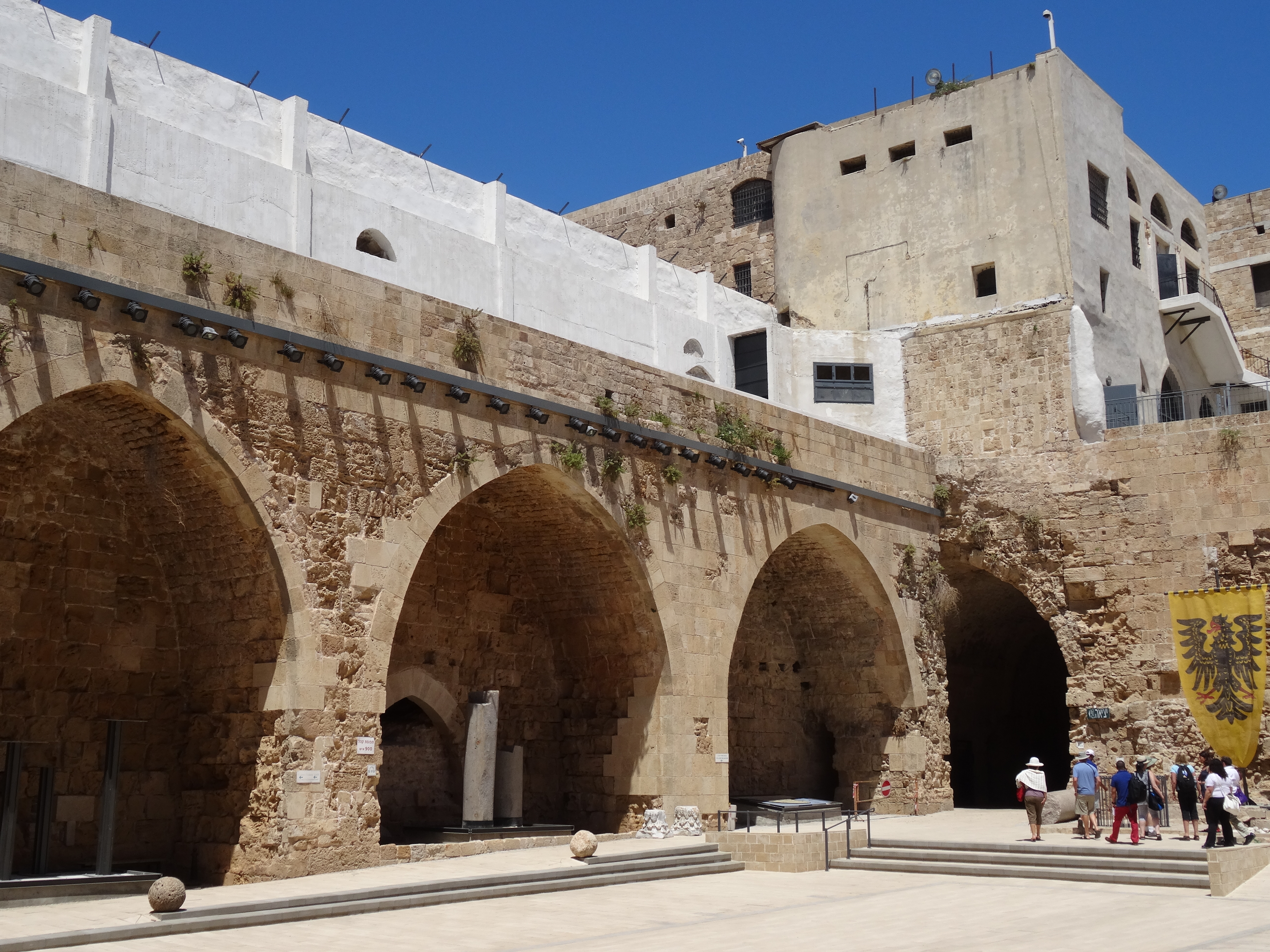
On our third day we took a half day trip to nearby Bethlehem. For this we had to cross into the Palestinian controlled sector of the West Bank and our Israeli driver had to be supplemented by a Palestinian guide once we crossed the checkpoint. Our driver told us that he is issued a special permit to enter this area as Israelis are not normally allowed into the Palestinian occupied zone. His point was underscored by huge warning signs stating that “Entrance for Israel citizens is forbidden, dangerous to your lives and is against Israeli Law”. Despite this somewhat somber warning, neither of us felt in any danger throughout our visit and simply marveled once again at the sites of such historical and religious significance that we would see.

DSC00491

The Shepherds’ Field

The first of these was the “Shepherds’ Field”, the presumed location, about a mile from the Nativity site, where the shepherds were told of the birth by the angels. A point which had previously been lost on us was that, up to this point, lambs had been sacrificed to God and that this particular flock was in effect being reared for that purpose. So, in addition to what must have been an alarming message from the Heavenly Host, these men were being told that they no longer had a livelihood!


Today there are two buildings to commemorate this revelation; a small church at the point where the shepherds were told and which contains three murals depicting the events of that day; and an even smaller chapel built over the cave that was used for their shelter while tending the flock. Our guide made it a “living scene” and, although it did not have the same intensity as that experienced at the Crucifixion site two days ago, the green grass, together with the cypress and palm trees all around, now made it the truly pastoral scene that it was then.


We then drove to the Church of The Nativity itself. This church has existed in some form for 1500 years and was built to replace the original one on this site commissioned by the Emperor Constantine and it sits above the cave where the birth of Jesus took place and the manger just a few feet away.

DSC00506

The star marks the Birthplace of Jesus


DSC00500

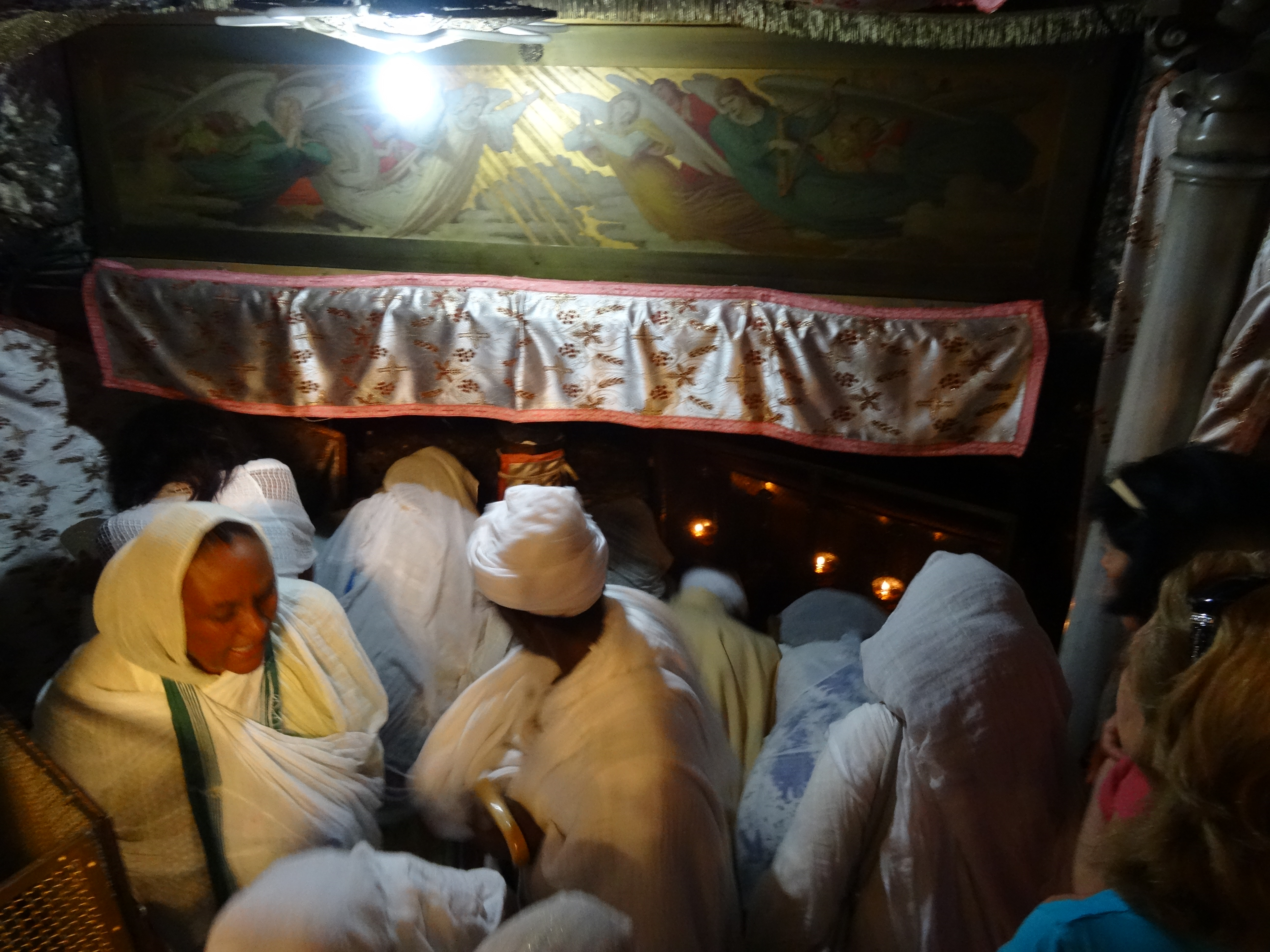
The (very crowded) Manger


The under floor space is small and has a roughhewn ceiling (it was a cave) and only a limited number of visitors are allowed down the ten or so steps to the two points of pilgrimage. Despite uniformed crowd control personnel (and much shouting and pointing), the area of the manger was very crowded with much pushing and elbowing for position – or so it seemed. Clearly almost everyone there was on a once-in-a-lifetime visit and wanted to get close to and touch the Holy sites so there was a “Not so Christian” clamor for position in claustrophobic quarters.

However, we were at the presumed site of Jesus’ birth so a slight discomfort and a rushed feeling were a small price to pay for the experience. Presumably the crowded and frenetic feelings of the visit itself will fade soon and leave only the inescapable fact that we have been to the site that started two thousand years of change, and yet of an undeniable constancy. Again I feel obliged to say that, no matter what faith, and to what extent that that faith is manifested in any individual, there can be little debate that the events at this site and those of thirty years later just a short distance away, have prompted the best in art, sculpture and music – and incredible emotion in those who have seen and heard them. The spiritual aspect is either a basis for these feelings or an incredible bonus for those who are so moved.


Leaving the frantic commotion of the Church of the Nativity, we walked about ¼ mile to the Milk Grotto. Again, a confession: this was new to both of us. Supposedly this was the place where the Holy Family hid before their flight to Egypt and it is said that Mary’s milk as she was feeding Jesus fell to the floor and turned the cave into a beautiful white stone. Certainly the stone is white today (unlike the reddish brown one sees on entry) and the quiet, underground room is a tranquil respite from the busy Nativity scene. It is quite serene and contains a beautiful icon of the Virgin and Child. It was an ideal spot to complete our tour of Bethlehem and start the return journey to Jerusalem.

DSC00522

The Milk Grotto


The tour we took on Day 4 (Saturday) had the single destination of the ancient city of Jericho. Once again we entered the Palestinian sector but, as yesterday, with no problems and no feelings of insecurity.


Our guide had, as he said, “lowered our expectations” on the road to Jericho telling us not to expect to see the walls that came tumbling down nor, indeed, any walls of consequence in the city. In fact it turned out that much of the city – certainly the area we visited – is an enormous archeological site and there are examples of walls, rooms and artifacts that date not just from the time of Joshua (1300BC) but, it is claimed, go as far back as 7000 years ago. There were even claims that a city had been formed here as early as 10,000 years ago.


The site being excavated looked essentially abandoned today and our guide told us that money is in short supply for a continuation of the work. Nevertheless, we did see some examples of structures, now well below ground level that were built by some of the earliest non-nomadic people on earth. This area, close to the Jordan River had a plentiful water supply (not so obvious today) and this promoted farming and the establishment of permanent settlements.


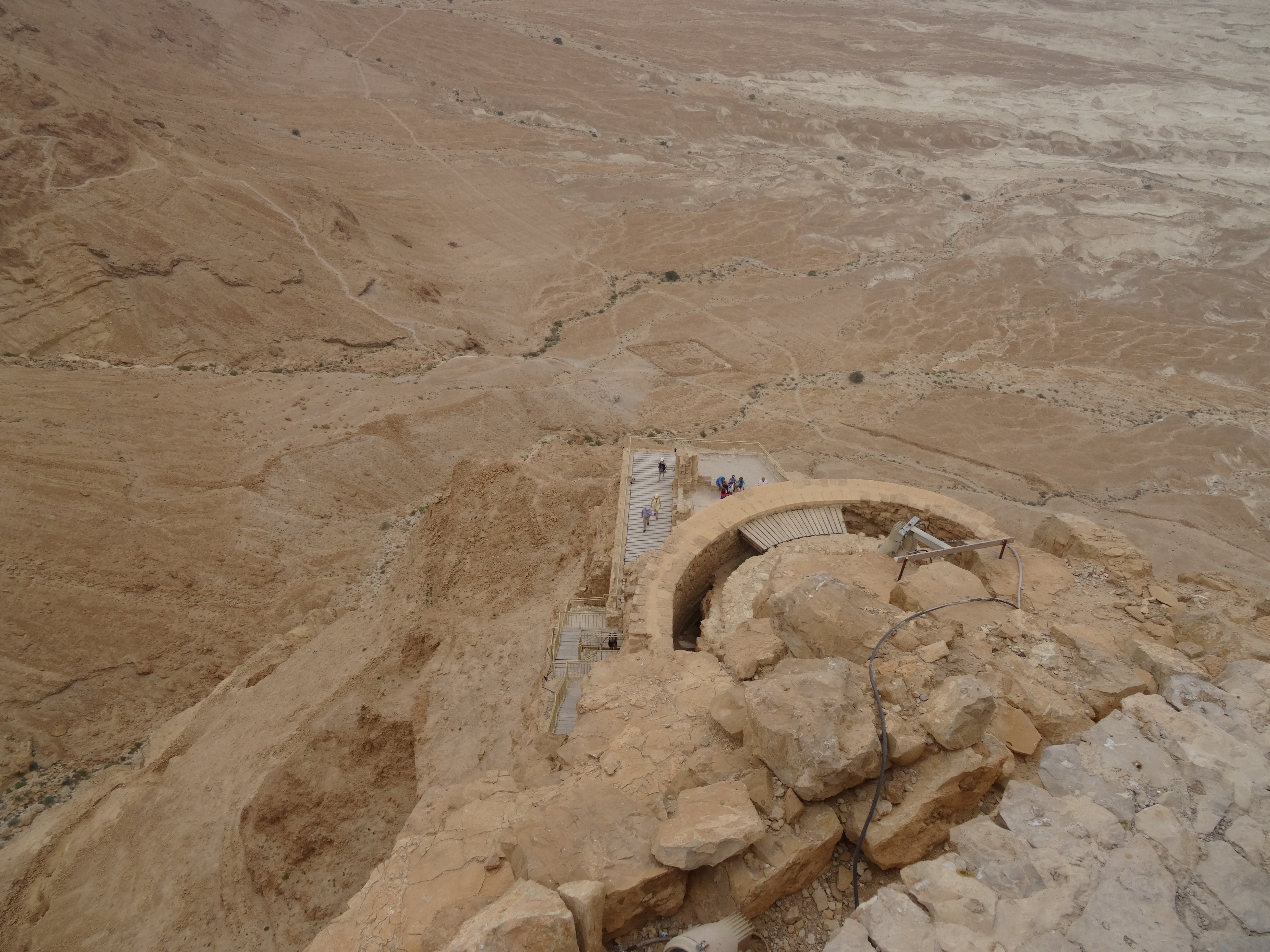
Of slightly more contemporary interest, the hill desert beyond the city of Jericho is where Jesus spent his forty days and nights of fasting right after being baptized in the nearby Jordan. This is the Hill of Temptation which rises steeply from city level and now houses a Greek Orthodox Monastery about 2/3 of the way to the summit. At the summit are the walls of one of three palaces that Herod is said to have built in Jericho; obviously he was a powerful and rich man who learned to live well during the Roman occupation.


Also in Jericho is the Sycamore fig  tree into which Zacchaeus climbed to catch a better view of Jesus as he came through the city and was commanded to come down as Jesus wished to visit with him in his home – an unusual request of the unpopular tax collector who was seen more as a servant of Rome than as a “local”. Although the tree we saw is centuries old, it seems unlikely that we were looking at the one climbed in the Bible story. We did see a still-functioning spring of fresh, potable water that was supposedly made drinkable by Elisha who threw salt in the source to purify it.

DSC00545

The Temptation Widerness

DSC00538

The Sycamore (Fig) Tree


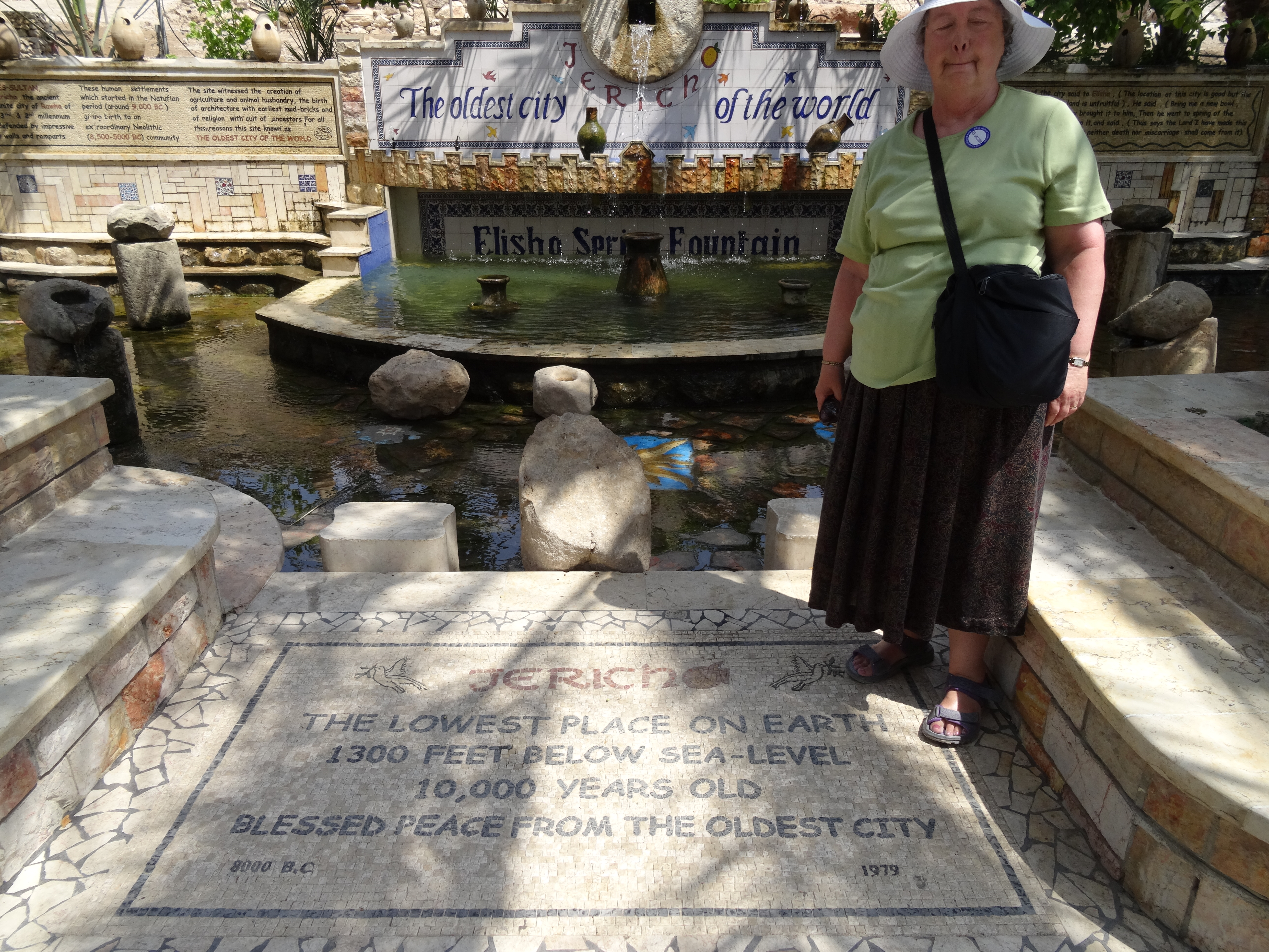
Regardless of the absolute authenticity of these – and many other Biblical stories from this region – we were now a part of that history. We were in Jericho, the oldest city on earth and certainly the lowest (1300 feet below sea level); we had climbed (just a little way) up the Wilderness desert of Jesus’ period of Temptation; on our way from Jerusalem we had been essentially on the road of the Good Samaritan; and we were now standing within a mile of the Baptism site (just across the River in Jordan and a place we had actually seen several years ago on a visit to that country). Simply being here was a privilege.

DSC00570

Jericho – the oldest city on Earth


We returned to Jerusalem and then walked along the ramparts atop the city walls. We chose to cover about ½ mile on the south and east sides. The views of both Old and New cities were magnificent on a sunny, warm afternoon but the walk was quite a challenge as the ramparts changed levels with great frequency and with very steep steps!


We re-entered the Old City near the Western (Wailing) Wall and saw the famous prayer site below Temple Mount. Presumably because our visit was towards the end of the Sabbath there were no crowds and only a handful of people touching the portion of Wall that we saw (no photographs allowed). Once again, however, we were immersed in a piece of history and at a place of deeply religious importance to those of the Jewish Faith. These sites – Jewish, Muslim, Buddhist, Hindu or Christian in whatever part of the world, provide experiences that make traveling the passion that it is for both of us.


We returned to the Jaffa Gate along the narrow, crowded streets of the Muslim Quarter in sharp contrast to the Jewish-populated areas. Those of the Faith who were out and about were generally on the way to or from the synagogue and dressed accordingly. I can recall post-war England being similar on Sundays when I was young and the shock-wave of “Sunday opening hours” that began in the sixties. That melting of the Sabbath into just one of seven days has clearly not occurred here.


Permanent link to this article: http://tykesabroad.com/israel-days-3-and-4-bethlehem-and-jericho/

Israel, Day 2: Massada and the Dead Sea

On our second day in Israel we took a full day tour to Massada, a Roman fortress of immense importance to the Jews on a mountain overlooking the Dead Sea. Jerusalem is at an elevation of about 2500 feet above (Mediterranean) sea level but our initial destination today was the lowest place on earth – the Dead Sea, at1400 feet below sea level. So, in a distance of less than 20 miles we descended about 4000 feet on a well-paved divided highway.


We were now in the West Bank (of the Jordan River) and in an area that has been the center of conflict between Israel and Palestine for decades. There are three defined areas to the West Bank (although the boundaries are much convoluted – and often disputed); one entirely under Israeli control; one entirely under Palestinian control; and a third, essentially within greater Jerusalem, that is under joint administration. Our guide was quick to point out that our entire day would be spent in the Israeli controlled region and would therefore be safe!


Although Jerusalem itself has many lush areas and is surprisingly green and filled with decorative flower beds and parks, we were now in true desert – almost barren, rock covered and hot! Even here, however, there were green areas along what were now dried river beds and there is sufficient rainfall at the higher elevations to create seasonal flooding and sufficient irrigation to support a number of farms and kibbutzim. The overwhelming feel, nevertheless, is that of a mountainous, rocky terrain which borders a large inland lake – the Dead Sea.


The Dead Sea is fed only by the Jordan River, which is now so heavily dammed and depleted of water for upstream farming and industry that the Sea level is dropping at an alarming rate of about 3 feet per year. The water level has dropped so much that the lake is now in two parts and a project is underway to “refill” the Dead Sea with waters from the Red Sea to the south. A joint Palestinian, Israel and Jordan agreement will build a canal (actually just a pipeline) with the hope of maintaining, or even adding to, the water in the Dead Sea. It is interesting to note that the water flowing northward will actually be brine (from a desalination plant) in order to maintain the mineral level of the Dead Sea and preserve its health attributes and its tourism.


A “swim” in the Dead Sea (after an appropriate covering with therapeutic mud) was scheduled for the afternoon of our visit (we chose to decline, having performed this ritual several years ago only a few miles away in Jordan) but first we went to the site that had caused us to take this tour. This was the ancient Roman fortress city of Massada, occupied and made palatial by King Herod when he was puppet king during the Roman occupation. It was built on top of, and terraced down from, a mesa-like hilltop 1300 feet above the Dead Sea.


During the first of the Jewish-Roman wars, Jewish rebels – the Sicarii – overthrew the Roman garrison and were further supplemented by more Sicarii after the second temple at Jerusalem was destroyed. In 73AD the Roman Governor decided that it was time to take back the fortress and laid siege from several (still obvious) encampments surrounding the hilltop.

Model of Massada Fortress and Palace

Model of Massada Fortress and Palace

Massada today

Massada today


Eventually an enormous ramp was built by the Romans and designed to allow troops to storm the fort at wall level. The Jewish Zealot occupiers realized that they were about to be beaten but rather than surrender to the Romans they chose to “surrender to God” and kill themselves. Of the almost 1000, ten were selected to do most of the killing and then were to kill themselves in turn. This apparently happened and was later confirmed and recorded by a few women and children who had hidden throughout this mass killing and later surrendered to the Romans.


In addition to being a legendary site of martyrdom, the fortress and palace were magnificent examples of Roman architecture and art and were as impressive as many other examples throughout the Empire. Even today there are clear examples of the traditional bathhouses, cisterns, mosaics and frescos typical of the advanced civilization of the time.

Roman underfloor heating in bath house

Roman underfloor heating in bath house

Roman fresco

Roman fresco

Although it is possible to walk up to the fortress via a “Serpent Path”, we were fortunate that a 3000 feet cable car ride is available today and that was the approach we selected (as well as for the descent after our visit). We spent about two hours wandering the ruins and trying to picture the area as it had once existed. To this end there were several excellent models showing not only the overall complex but also depicting specific buildings, complete with columns and mosaic floors. As an archeological site it is certainly impressive and is made all the more interesting as a historically important example of the Jewish Faith.


The late morning on the mountain was a little overcast and there was a slight cooling breeze at that elevation. During the following two hour visit to the Dead Sea resort, however, the skies became clearer and the breeze dissipated such that it was 100F in the shade where we spent most of the time while our fellow tourists dipped and floated in the warm waters – and the much hotter air.

Dead Sea bathing!

Dead Sea bathing!


First cover yourself with mud and the float!

First cover yourself with mud and then float!

Permanent link to this article: http://tykesabroad.com/israel-day-2-massada-and-the-dead-sea/

Israel Day 1; The Church of the Holy Sepulcher and Stations of the Cross

On our first full day in Jerusalem we walked the 15 minutes or so from our hotel to the Jaffa Gate, one of several entrances to the Old City. Old Jerusalem (walled in the Middle Ages – at least in this form) is divided into several Quarters and we entered at the edge of the Christian and Armenian Quarters. It was the Christian Quarter where we would spend most of our time today, although we did wander a little into the Muslim area – where a young man told us “this was for Muslims only” (I am not convinced that was entirely correct) but he did re-direct us to the route we really wanted!

Our main focus today was in the Church of the Holy Sepulcher which is built over the site of Jesus’ crucifixion, burial and resurrection. The present-day church is administered by several Christian churches and secular organizations in a complicated arrangement that has lasted for centuries. While the Greek Orthodox and the Roman Catholic Churches have a permanent presence here, Anglican and Protestant Churches do not, and some regard the Garden Tomb (just outside the city walls) as the site of the crucifixion and resurrection.

DSC00270

The Unction Stone

DSC00264

The Church of the Holy Sepulcher


After 2000 years of history, wars and different occupying forces it seems to me that a precise positioning might be open to debate, but I find that of little real consequence. Here we were, entering a church dating from the fourth century, albeit essentially re-built to its present form at the time of the Crusades, that may stand on the Biblical Golgotha (Calvary), and may enclose the Unction Slab (where Jesus’ body was prepared for burial), as well as the actual tomb in which He lay for three days before the Resurrection.

So this site may not be exact. It may be a few miles away or somewhere else entirely. Nevertheless, this particular site caused early Christians to build a church which has brought countless people of all faiths here, just as we were today. The events of the time and their place in History are a matter of both record and Faith and it is the latter that is pre-eminent for most who visit here. If this church (beautiful in its own right but – almost to be expected- overshadowed by the chapels, altars and annexes pertaining to the Death and Resurrection of Christ) can represent a point of focus for Believers, then that should be sufficient. If, as so many clearly believe, Calvary is here and not “somewhere in the vicinity”, then that must surely add to its Center of The World claim under the dome of the Crusader Church. For my part, I knew that I had to visit every corner of this world-famous site and see the final Stations of The Cross, the altar over the stone where the Cross was erected, the Tomb of Joseph of Arimathea and, of course, the sepulcher itself. In this latter I was thwarted today by the long lines but……. another day, perhaps.

We were, however, able to lay our hands on the Unction Stone. This particular slab dates only from 1810 and even the tradition is attested only to the Crusader era so, once again, absolute points of reference and physical details may have been amended with the passing of time. For the prostrate faithful who touched and wiped the stone with handkerchiefs or briefly laid candles or other mementos on the tablet in reverence, the connection to the Savior was clearly manifest regardless of global coordinates.

DSC00282

The Bust of Mary at Station XII


DSC00285

The altar above the hole in which the Cross was placed

DSC00298

The Tomb of Joseph of Arimathea

So, the site of the Crucifixion and Resurrection is not “a green hill far away, without a city wall” anymore and that image has been complemented in our minds by a completely different – but equally deeply etched – picture of closely spaced sites under one roof. If these sites are indeed in the correct geographical locations, the proximity of Cross and Tomb (about 100 feet) is perhaps one of the more surprising revelations of the visit for me.

Following our two hours in the Church we had coffee at a street café and then started down the Via Dolorosa to visit (in reverse order) the Stations of the Cross outside today’s church. Each Station is marked by the appropriate number on the wall of the nearest building and several also have small chapels. The walk of less than half a mile follows an almost straight line through today’s narrow (less than 10 feet?) streets lined with shops and businesses. Again, the picture of an open, steep, perhaps grassy or stony path of 2000 years ago (my image) has been replaced by this paved route crowded by buildings such that the sun rarely reaches the pavement. It is today (and probably has been for a very long time) one of the major arteries of the Old City and is reminiscent of so many Middle Eastern souks or market areas.

DSC00334

Station II

DSC00316

Station VI

DSC00318

Station V


Some of the Stations have inscriptions, others an appropriate New Testament reference, but for the most part specific descriptions must come from an ability to navigate the Gospels and, indeed, the Old Testament – or carry a good guide book! Stations I and II, at the end of our walk, are widely regarded as the Praetorium referred to in the Gospels and are on the site of the Antonia fortress where Jesus was condemned by Pontius Pilate, scourged and given His cross.

This marked the end of our journey for today, although we still had to walk back up the Via Dolorosa (again nowhere near as steep as my prior image), past the Church and out of the Old City via the Jaffa Gate. The city walls, dating from the early 16th Century when Jerusalem was part of the Ottoman Empire, are still intact and parts of the ramparts are available for a short walking tour – but our legs told us that experience would have to wait for another day!


Permanent link to this article: http://tykesabroad.com/israel-day-1-the-church-of-the-holy-sepulcher-and-stations-of-the-cross/

Great day for Baseball

2527 2521 2519

Saturday April 19

This was the first baseball game of the season for Cameron after several cancellations due to weather and wet pitches. It was also his first game in the PYO Diamond Reds uniform . He hit safely to first just once, stole second, then third and narrowly missed scoring when he just missed stealing home. All was in a winning cause – the Reds won 12-1 and the game was called after five innings. With temperatures in the mid-sixties and a clear blue sky, it was a perfect day for playing – and watching – baseball.

Permanent link to this article: http://tykesabroad.com/great-day-for-baseball/

Off to The Holy Land

April 2014.

Shortly we will be leaving for a twelve day visit to Israel where we plan to stay in both Jerusalem and Tel Aviv. This is our first visit to this country and we are excited about the many Biblical sites that we will see as well as experiencing the culture of the Middle East again.

We feel fortunate that we have already visited several countries in the area and have been moved when visiting places of historical importance referenced in the Bible. We have seen the land of the Pharaohs in Egypt and followed much of the Exodus route from the Red Sea through the deserts and hills of Jordan, east of the Dead Sea.

One of the most moving experiences of that visit to Jordan was standing on the top of Mt Nebo and facing west. From here the full effect of reaching the Promised Land could be seen, albeit a little hazily during our visit. Here was the northern end of the Dead Sea to our far left, the Jordan River running north-south through the middle of the view, and Jerusalem, Jericho, Rammallah and the rest of Palestine on the far horizon. Our view that day was less than perfect and a good guide and a little imagination were necessary to hazily pick out the sites, but the experience was one of those “once in a lifetime” that you just didn’t want to leave.

DSCF0109

Jesus’ Baptism Site near the River Jordan

We were reminded that Moses himself never actually set foot in Palestine and, as the last of the generation that had fled Egypt forty years earlier, had climbed to this spot and had died here. He must, however, have seen the future home of his children, just as we were seeing it that day in 2006.

DSCF0054

The View of The Promised Land as seen by
Moses (1300 BC), Pope John Paul II (May 2000)
and Molly (March 2006)

Also in Jordan we visited the supposed site of Jesus’ baptism by John. The River Jordan separates modern-day Jordan and Israel and, as a result of upstream damming, is little more than a trickle along much of the border. The Baptism Site itself is now dry and is reached via a rough boardwalk and path (and a military escort) designed to avoid landmines that still exist from recent conflicts.

So, the Jordan River is a stream and the Baptism site is a dry bed with a small stone marking the alleged exact spot. The whole could be a huge disappointment. But it is not, because there is sufficient evidence to identify a small area in which one of the most profound events in history took place and whether we were standing exactly on the baptism site or a few feet away, or even a mile away, didn’t seem to matter. It was for us the same feeling that we had had on top of Mount Nebo; whether that was the exact spot from which Moses saw the Promised Land didn’t change the fact that, for sure, he and we had had a very similar view separated in time by over 3000 years. Similarly, somewhere very close to where we were now standing, Jesus and John the Baptist had also stood 2000 years ago. It is that recognition that makes history come alive and is a major reason for our travels around the world.

On other trips to this part of the world we visited Corinth in Greece (unfortunately most of the Roman area where St Paul’s Letters would have been heard was a closed archaeological site) and Ephesus in Turkey. Here we certainly walked the same street past the Library and market place as had St Paul (when he wasn’t imprisoned) during his 3 1/2 year stay after the Ephesian Church had been founded by St John. These are “goose bump” moments that – regardless of faith – must surely be experienced by the thousands who visit here.

On a recent Sunday we were reminded by the St John Gospel reading that we have also visited the church built over the (second) tomb of Lazarus. This was in Cyprus, where Lazarus of Bethany was appointed Bishop after fleeing Judea, and where he lived for thirty years. Whether this site and its story is apocryphal or historical fact is for the visitor to feel for himself – but for us it was another of those experiences that make travel such a privilege.

So now we are about to leave for a country that will surely provide many more of these “I can’t believe we are here” emotions and we hope that we will be able to adequately convey these feelings as you follow our posts on this site.

Permanent link to this article: http://tykesabroad.com/off-to-the-holy-land/